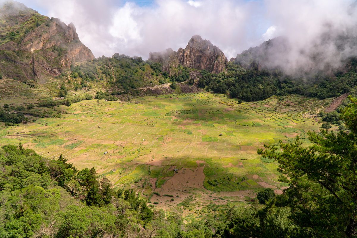
Cova de Paul
30 min drive
This volcanic crater is best visited when high-altitude clouds are thin, offering views of the surrounding green valley.

Santo Antão experiences one of the most varied climates in Cape Verde, with conditions shifting from semi-arid coastlines to lush highland valleys within a few kilometers. The island's dramatic topography creates distinct microclimate zones that determine when and where you can hike comfortably.
Quick answer
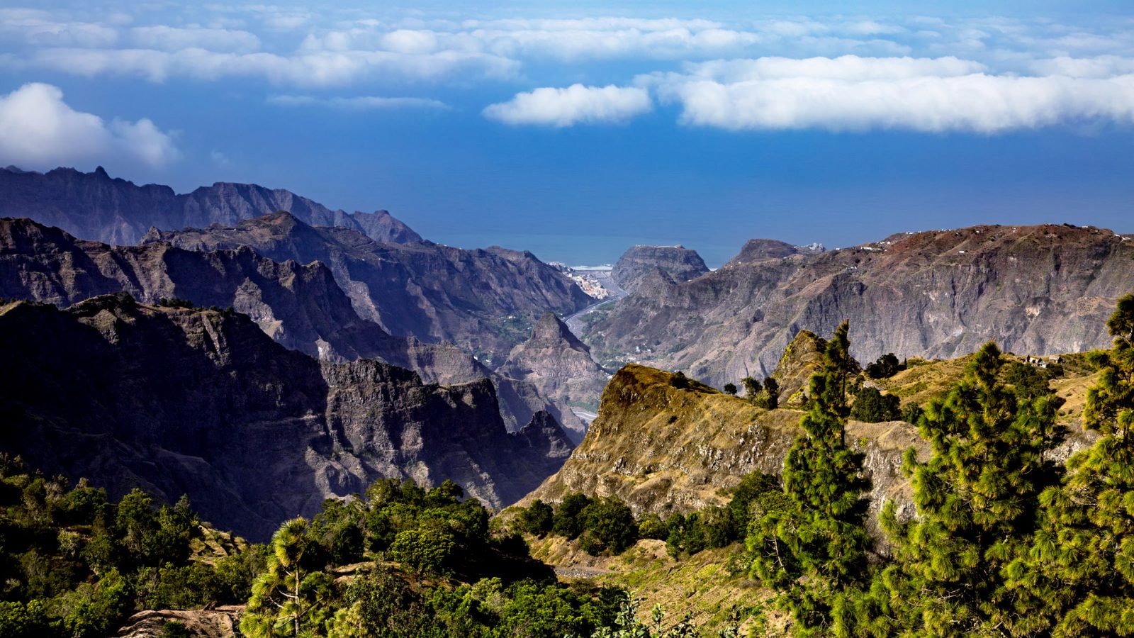
Santo Antão weather divides into a dry season from November through June and a brief rainy season from July through October, though rainfall totals and patterns vary dramatically by altitude and coast. The northeastern windward slopes receive significantly more precipitation than the southwestern leeward side, creating green valleys in Paúl and Ribeira Grande while Porto Novo remains arid year-round. Clearer skies and lower temperatures occur before 11:00, especially in higher altitudes where afternoon cloud buildup is common regardless of season.
The island sits 1,600 kilometers off the West African coast where the northeast trade winds collide with volcanic peaks reaching 1,979 meters at Topo da Coroa. This collision forces moisture upward along the windward slopes, condensing into clouds that drape the northern mountains while the southern coast bakes under uninterrupted sun. A single morning drive from Porto Novo to Ribeira Grande crosses from desert scrub through terraced sugarcane valleys into cloud forest, each zone operating on its own rainfall calendar. Rainfall totals tell only part of the story. The northeastern highlands around Ribeira Grande and Paúl can receive 400-600mm annually, concentrated between August and October when tropical moisture pulses northward from the intertropical convergence zone. The southwestern coast around Porto Novo sees under 100mm in most years, with some years recording no measurable rain at all. But even during the dry months, morning fog and cloud cover deposit enough moisture on the windward slopes to sustain agriculture, a phenomenon locally termed "horizontal rain" that keeps the terraces green when the rest of Cape Verde turns brown. Temperature stability is the island's defining characteristic. Coastal areas hold between 22-28°C year-round, while highland villages like Chã das Pedras sit 5-8°C cooler, occasionally dipping to 12°C on January nights. The diurnal range matters more than seasonal swings for trip planning. Mornings offer the clearest visibility and coolest hiking conditions, particularly above 1,000 meters where clouds build predictably after midday from November through April and persist most afternoons during the rainy months. The trade winds blow consistently from the northeast at 20-35 km/h, strong enough to lean into on exposed ridgelines but essential for moderating coastal heat. They peak in intensity from December through March, the same months when Atlantic swells build along the northern coast and ferry schedules between São Vicente become less predictable. The southern port at Porto Novo remains calmer year-round, protected by the island's bulk from the dominant wind and swell direction.
“A single morning drive crosses from desert scrub through terraced sugarcane valleys into cloud forest, each zone operating on its own rainfall calendar.”
The optimal time to explore Santo Antão is during the best arrival window of 08:00–11:00, which ensures clearer skies and lower temperatures before afternoon cloud buildup occurs at higher elevations. Planning visits between October and June helps hikers avoid the peak humidity and potential rainfall of the late summer months.
Dry trade winds, 20°C–25°C
Consistent weather creates stable conditions for hiking across the island interior.
Mild temperatures, 22°C–26°C
This period offers a balance of comfortable warmth and clear visibility for mountain trails.
—
Arriving during this window minimizes exposure to the cloud cover that frequently forms in high-altitude zones during the afternoon.
Verdict: The best time for optimal weather is from November to May, specifically arriving between 08:00–11:00 to capitalize on clear morning skies.
Santo Antão is a public island territory accessible at all hours. While the terrain remains open throughout the day and night, weather patterns influence visibility and safe travel conditions across the island.
Santo Antão's micro-climates shift rapidly between coastal heat and mountain fog, requiring layered gear and protection.
The microclimates of Santo Antão allow for diverse experiences depending on local cloud cover and wind patterns. Exploring these nearby landmarks provides a practical way to manage your day based on current visibility and trail conditions.
30 min drive
This volcanic crater is best visited when high-altitude clouds are thin, offering views of the surrounding green valley.
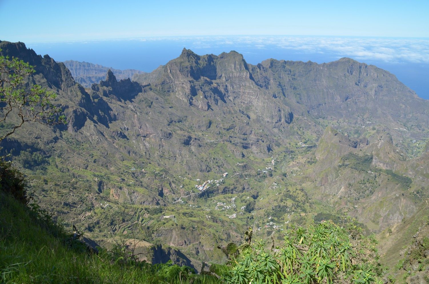
45 min drive
Descending from the highlands toward this valley allows you to experience rising temperatures and lush tropical vegetation as the weather warms.
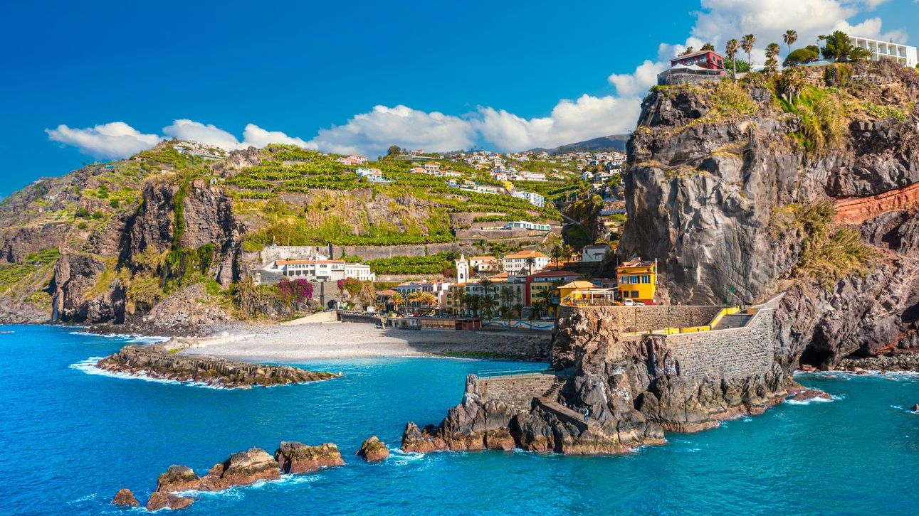
60 min drive
This coastal village remains accessible even when interior mountain paths face heavy mist, providing a clear maritime environment.
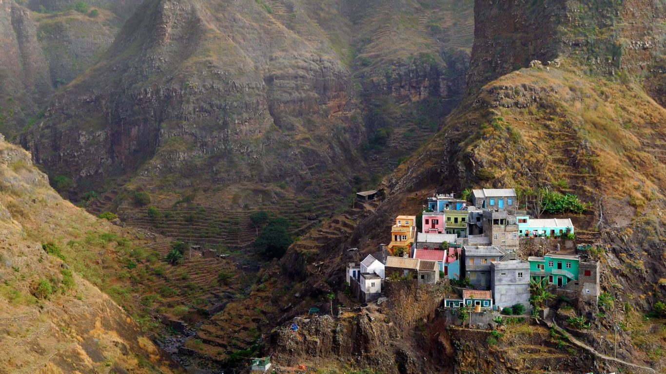
75 min drive
Located on a cliffside, this settlement is sensitive to wind; clear conditions are necessary to appreciate the vertical topography.
Everything you need to know about santo antao weather
The climate on the island is generally temperate and dry, though it varies significantly due to the rugged topography. You will encounter varied conditions ranging from arid coastal zones to misty, lush mountain highlands. Always monitor local forecasts to understand how the current santo antao weather might affect your outdoor plans.
To experience the most favorable conditions, aim for the morning hours. Clearer skies are more frequent during this window before the typical cloud buildup occurs in the higher altitudes. This makes early planning essential for enjoying the island landmarks under optimal santo antao weather.
Yes, the microclimates are distinct, as the mountains often trap moisture compared to the sunny coastline. Travelers hiking through the valleys frequently find that the temperature drops and humidity rises as they ascend. Checking the weather for specific elevations helps you navigate the diverse landscape of this Cape Verde treasure.
There is no entrance fee to access the island, as it is a public territory. You can arrive and explore the terrain without needing to pay any site-specific admission costs. Visitors are free to transit across the island freely at all times of the week.
Given the island's variable nature, packing layers is the best approach to handle shifts in temperature or humidity. Bring sturdy footwear for uneven volcanic trails and reliable wind protection for the higher peaks. Being prepared ensures you remain comfortable regardless of what the santo antao weather brings during your journey.
We recommend a best arrival window of 08:00–11:00. Arriving during this period allows you to take advantage of clearer skies and lower temperatures before the afternoon heat and cloud accumulation. This timing is ideal for maximizing your time exploring the island's natural trails and mountain paths.